SaskPower
Since 2012, KBM has been working with SaskPower to build a province-wide dataset of the company’s transmission network and Rights-of-Way (ROW). Over the course of this complex, multi-year project KBM has collected and processed LiDAR and Imagery data to support vegetation management and other critical maintenance activities. As a result of the accuracy and quality of the data provided by KBM, the GIS was established by SaskPower as a “system of record” in 2015.
To date, KBM has built, maintained, and delivered an asset and vegetation management GIS for 12,000+ km of transmission line and transmission corridor. The data acquisition includes: high-resolution oblique and ortho imagery, video, and LiDAR data, which is distributed via a user-friendly web interface. This approach earned KBM the Esri Canada Award of Excellence in 2014.
KBM's Role
- High resolution ortho base maps;
- High resolution oblique imagery;
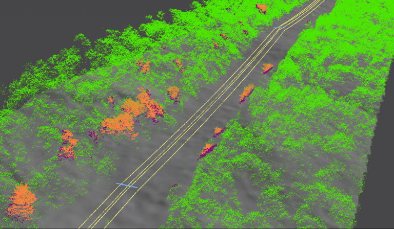
- GIS data derived from LiDAR and ortho imagery that provides information on assets, vegetation, flooding and encroachments, useful for managing transmission asset and vegetation related problems;
- PLS CADD packages used to plan re-routes and confirm lines were built according to specifications;
- Web GIS, a secure website built on ArcGIS and Geocortex technology that is easily accessible anywhere internet is available. The simple interface allows users to print maps, query and analyze the data without any previous GIS training.