
KBM Resources Group has extended its services in 2019 to become a full-service provider of fixed-wing aeromagnetic geophysical surveys. All geophysics equipment and designated aircraft are wholly owned and operated, providing customers with the ultimate in tailored service and flexibility. KBM strives to be the best value service provider for worldwide aeromagnetic surveying. Services include logistics, data acquisition, data quality control, final data processing and geophysical interpretation.
With the capacity to assemble field teams consisting of geophysicists with utmost international exposure and flight crews with thousands of hours of survey time, KBM is ideally positioned in the industry to optimize the outcome of your project.
Data quality control is performed daily on-site. Final data processing is completed in a timely manner using data processing techniques compliant with Geological Survey of Canada (NRCan) standards.
PROJECT SERVICES
- BID PREPARATION
- DATA ACQUISITION (PIPER NAVAJO PA31 CHIEFTAIN)
- FINAL DATA PROCESSING
- INTERPRETATION
BID PREPARATION
- Flight Path design and Drape Surface generation optimized for local geological and cultural considerations
- Calculation of total line kilometers
- Logistics including
- Fuel
- Parking, Landing and Hangar fees
- Transportation
- Crew Accommodation
DATA ACQUISITION (PIPER NAVAJO PA31 CHIEFTAIN)
- Mobilization
- Pre-survey flight tests including:
- Figure of Merit (FOM)
- Heading Test
- Lag Test
- Radar altimeter calibration
- Data Acquisition
- Data Quality Control
- Reporting to client
- Demobilization
FINAL DATA PROCESSING
Flight Path
- Differential GPS calculation
- Datum and projection shifts
Magnetic Data
- Diurnal correction
- IGRF (International Geomagnetic Reference Field) correction
- Levelling correction
- Taylor correction
- Micro-levelling correction
- Total field, derivative and reduction to pole grid generation
INTERPRETATION
- Lithostratigraphic and structural geophysical interpretation
- 2-Dimensional magnetic profile modelling
- 3-Dimensional Inversion
- Euler Deconvolution
- Tilt Derivatives
- Depth estimation

AIRBORNE GEOPHYSICAL SURVEY AIRCRAFT
KBM’s Piper Chieftain has been equipped with a Lake Central Air Services (LCAS) tail boom installation to support the magnetometer installation. The boom is specifically designed for the Piper Navajo series (including Chieftain) and the installation is authorized by Supplemental Type Certificate (STC).
FCAR is operated with a compliment of 2 flight crew, full fuel and all necessary survey equipment for each flight.
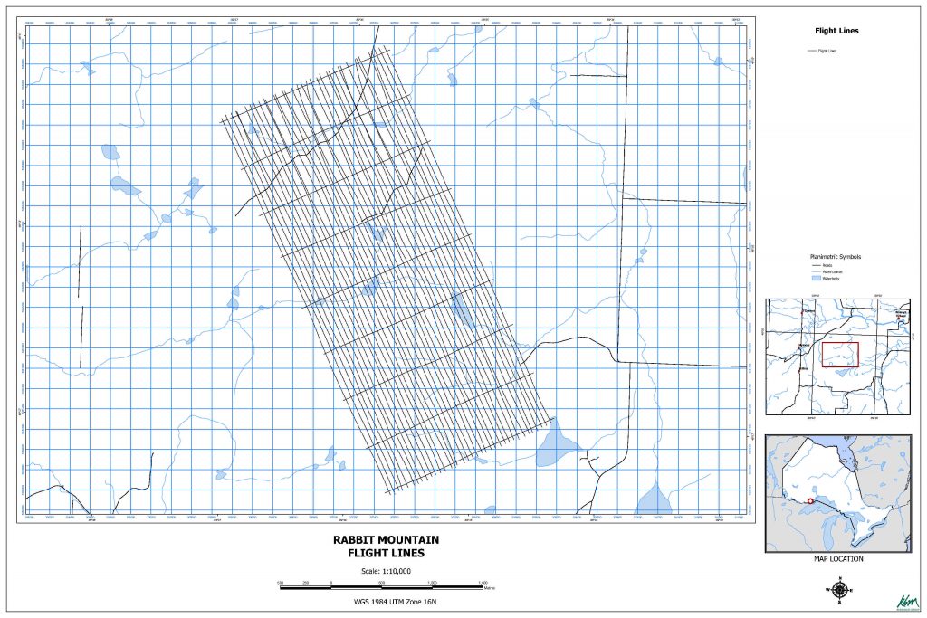
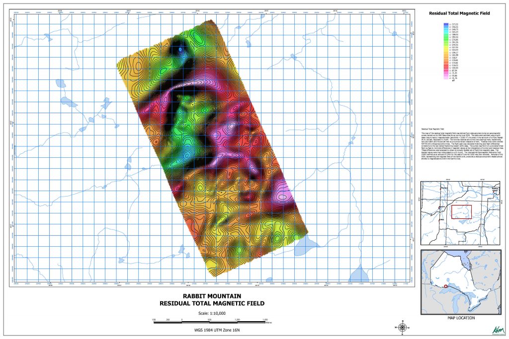
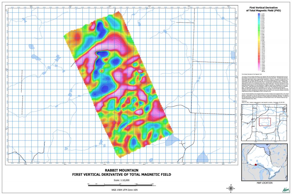
Rabbit Mountain Geophysical Case Study
- Planning
- Data Acquisition
- Processed Data
Planning
An ambitious project to survey Rabbit Mountain, in North-West Ontario, was designed to test out the capabilities of our pilots and our fixed wing system.
Data Acquisition
Our pilots flew the stringent flight plan very well on the first pass.
The southern end of the plan was flown near perfectly and the northern end had some minor deviations that could be easily fixed with reflight passes.
Processed Data
The acquired data were corrected and analyzed.
Following industry standards, Residual Total Magnetic Field and the First Vertical Derivative of Total Magnetic Field were derived. The final derived data are to industry standard and would be ready for delivery to a client for interpretation.